Although the start of winter is still far away, it is never too early to start looking at some indications of what the upcoming winter might bring. A notable development from the spring into the summer of 2023 was the formation of an El Niño pattern, which is a major change from the La Niña pattern that has dominated the globe for the past few years. An El Niño pattern typically favors above average sea surface temperature anomalies in the Equatorial Eastern Pacific, around the Galapagos islands, which in general leads to more thunderstorm activity and less nutrient-rich waters. The warmer these waters are, the stronger the El Niño tends to be, currently, the El Niño is considered to be a weak El Niño.

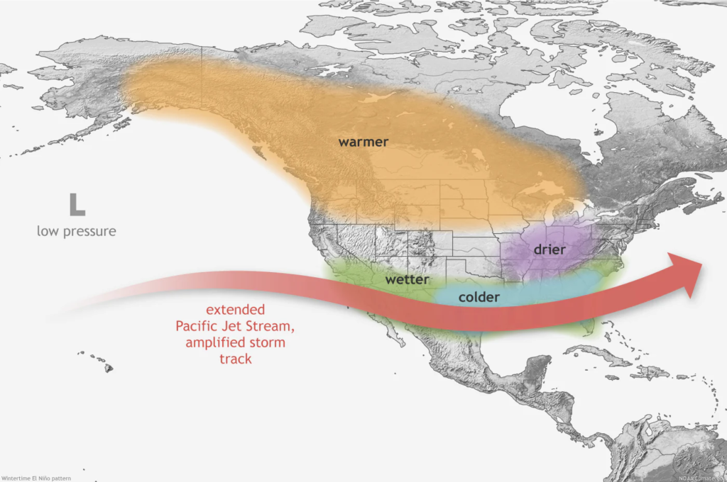
The general pattern for an El Nino features the Pacific Jet cutting across the southern tier of the U.S. providing frequent storm activity and generally cooler conditions, while much of the northern tier experiences warmer than average temperatures with the lack of frequent storms. The Ohio Valley also tends to be drier than normal away from the active jetstream track to the south.
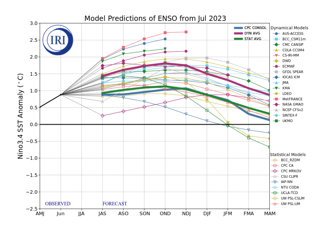
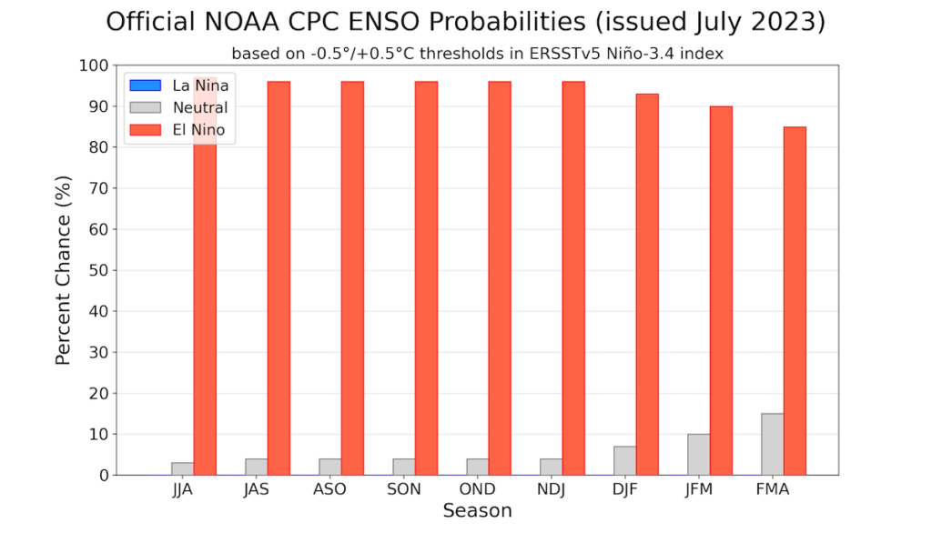
However, the El Nino is already in a weak phase, and is expected to intensify as winter approaches, with the NOAA providing roughly 90% probabilities of the formation of a Moderate to Strong El Nino by the winter of 2023-2024. Many forecast guidance models support this understanding with the continued increase in SST temperature anomalies in the Eastern Pacific.

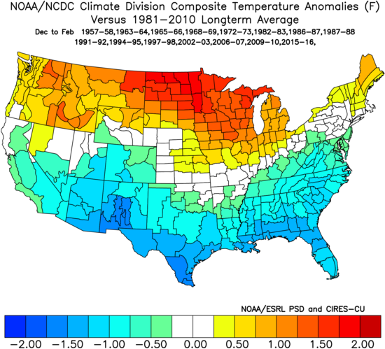
With the high chance of development of a moderate to strong El Nino by the Winter of 2023-2024, it is not only important to examine long range forecasts, such as those provided by the NMME, CanSIPS, and CFS, but also look at historical climatology for weak and moderate-strong El Nino episodes. Weak El Nino’s historically from December to March tend to favor below average temperatures for the Eastern two thirds of the U.S., while moderate to strong El Nino’s tend to favor below average temperatures across the Southern tier, and above average temperatures across the Northern tier. Precipitation from weak El Nino’s tends to be below normal for the Southeast, Midwest and Southern Plains, while above average precipitation is favored for the West Coast. Precipitation from moderate to strong El Nino’s tends to favor above average precipitation for the South, East Coast, and immediate West Coast, and below average precipitation for the Ohio Valley and parts of the Northwest.
Weak El Nino (1981-2010):
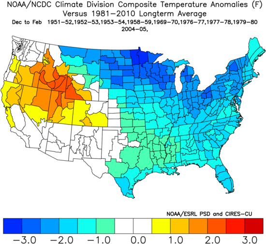
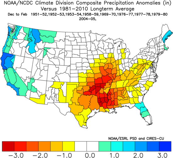
Moderate to Strong El Nino:

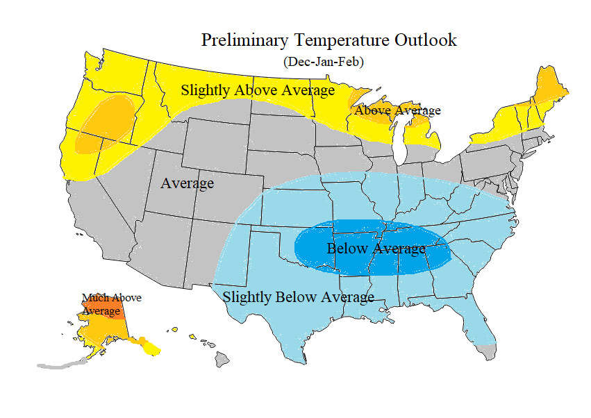
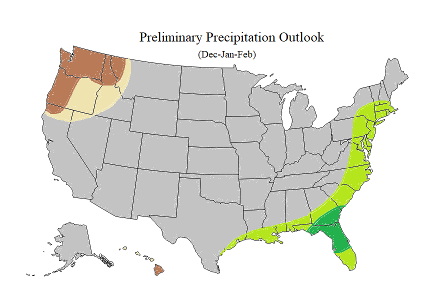
With all this taken together, Stemify has created a preliminary 2023-2024 outlook for both temperature and precipitation. Overall, below normal temperatures are expected for the Southeast, Southern Plains and into parts of the lower Ohio Valley, while above normal temperatures will extend widely across the Northern tier, particularly across the Upper Great Lakes, Northwest, Upper New England, and Alaska. In terms of precipitation, above normal precipitation is expected along the Gulf Coast and East Coast, with the bullseye targeting portions of North Florida and South Georgia. Below normal precipitation is expected across the Northwest.

Disclaimer: The Climate Prediction Center also creates similar seasonal outlooks but this outlook is not solely based on that of the CPC, the CPC outlook can be found here. These outlooks are only used for generic purposes and simply depict trends overtime, not day-by-day forecasts. Errors are possible in these outlooks due to the high amount of uncertainty of forecasting months in advance. Most data is obtained from Tropical Tidbits.

