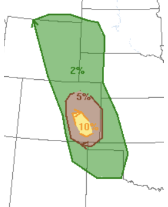
Severe thunderstorms producing large hail, damaging winds, and some tornadoes are possible across much of the central plains this afternoon and evening, with the greatest risk extending Eastern Colorado into Western Kansas and far Northwest Oklahoma. High levels of low-level moisture already present in the region combined with instability from daytime heating will promote rapid supercell development on the eastern plains of Colorado. Some Supercells may produce hailstones greater than 3 inches in diameter, and occasional damaging wind gusts. High levels of windshear will be present across portions of Eastern Colorado which may aid in some tornadic development. As these storms push east, they will become more linear in nature promoting a strong damaging wind event particularly into Kansas and Oklahoma. Strong mid-level winds will enhance this damaging wind threat.
Clusters of thunderstorms could develop in the high plains and northern Rockies as a trough enters the region, some of these storms could produce large hail, occasional damaging wind gusts, and an isolated tornado. A lack of shear will likely limit tornadic development, but an isolated tornado remains possible with support from strong mid-level winds.
Further southeast, the Arklatex region may also see strong to severe storms result from clusters moving southeast from Oklahoma, although daytime heating and Instability will be very high, very weak shear and mid-level support will likely inhibit widespread severe thunderstorm development. An isolated cell with damaging wind gusts will be the main threat for this region. Probabilities for prominent severe weather hazards are given below (the dashed area represent a significant severe risk):


